Full service andscape architecture
GRS provides a full spectrum of landscape architectural services.
From Rezoning support, through environmental entitlements to landscape and irrigation plans, we are experienced in all aspects of landscape architectural services needed to develop a project in Southern Arizona. We invite you to peruse our services and samples of our work.

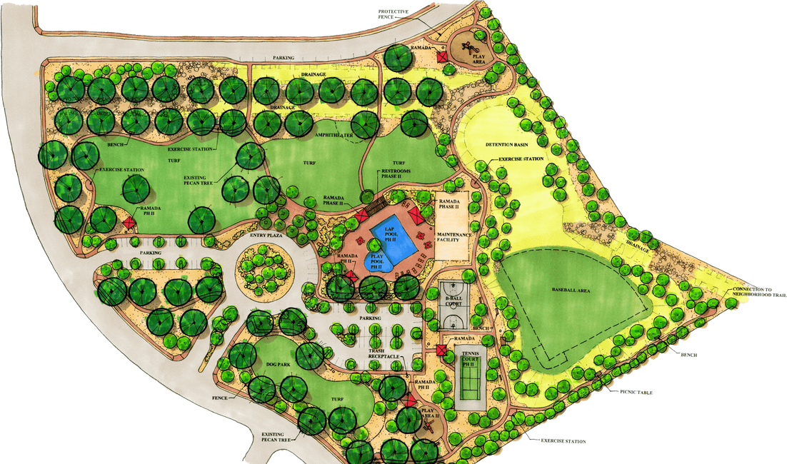
Landscape Plans
We provide creative design solutions and plans that are code compliant with the governing municipalities.
Landscapes for bufferyards, parking lots, detention basins, amenity areas, native plant compliance and riparian compliance are crafted together into a good looking, cost efficient landscape design.

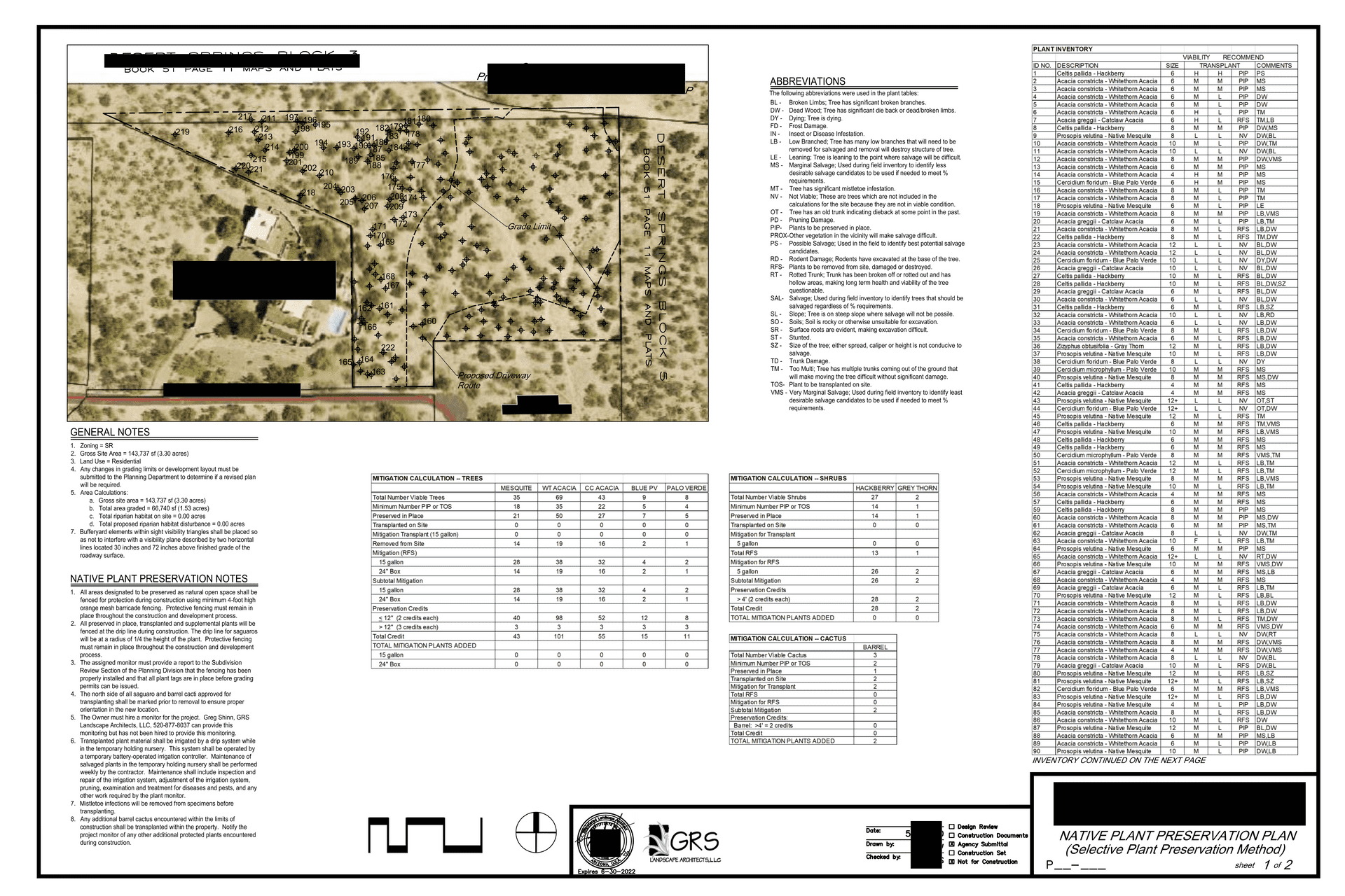
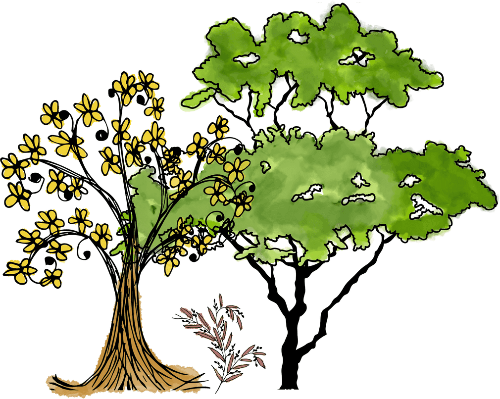
Native Plant Preservation Plans
Each municipality in the Southern Arizona and Phoenix metro area takes a different approach to the protection of native plants.
We understand these differences and create NPPO plans with an eye on the successful completion of our client’s projects. We have completed thousands of NPPO’s covering more than 50,000 acres of land.
Irrigation Plans
We are experts at providing water efficient irrigation design in conjunction with our landscape plans.
These plans are compliant with Pima County Water Conservation Requirements and City of Tucson Commercial Water Harvesting Standards.
Water Harvesting Plans
The City of Tucson has a unique Ordinance that requires the landscape architect to demonstrate that at least 50% of the required plant irrigation can come from harvested rainwater.
GRS has developed unique format for these calculations that simplifies the engineering and coordination of the Water Harvesting Plans.
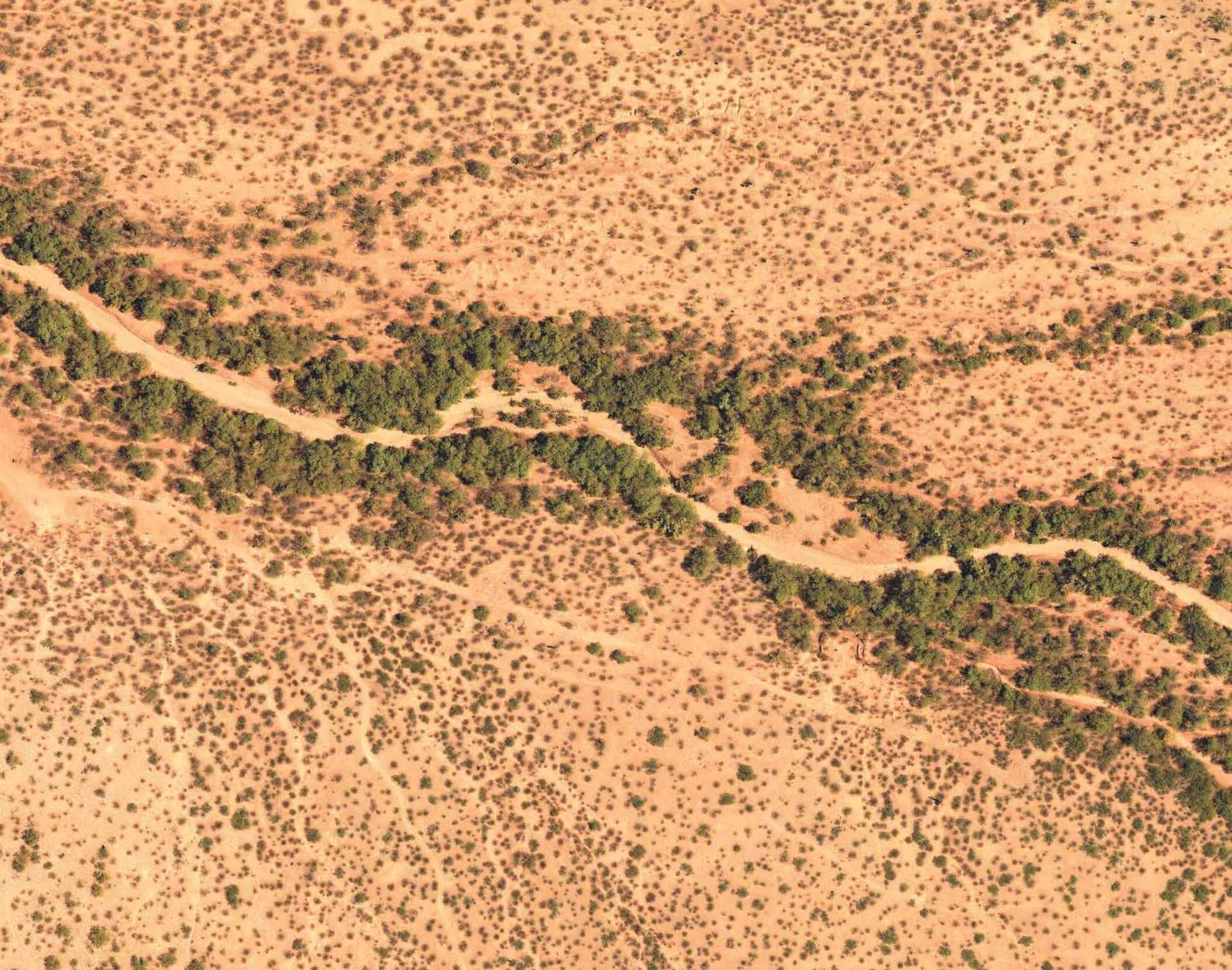
Riparian Habitat Mitigation Plans
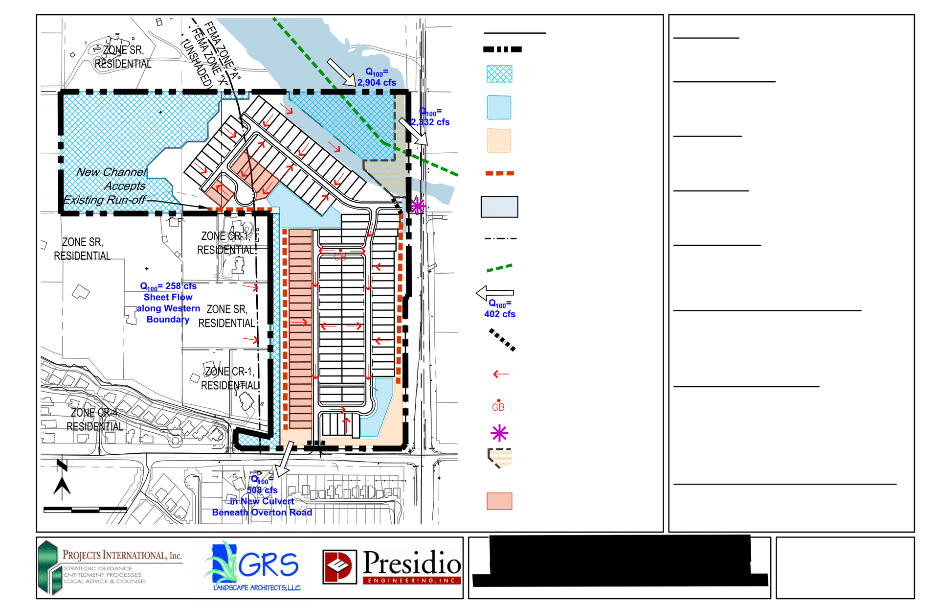
Pima County’s Riparian Ordinance requires preservation or mitigation of county-designated riparian areas.
These plans require careful analysis, a well-thought-out strategy and a full understanding of the many options available to achieve compliance. We use our expertise to achieve compliance while eliminating onerous restrictions on the property.

Endangered Species Search
We have two certified Burrowing Owl experts that can provide clearance of your site.
If owls are found, we can help facilitate their removal and relocation. We also have expertise in conducting Pima Pineapple Cactus searches.
Native Plant Inventories
Native plant inventories are used to fulfill a broad range of local Ordinances.
We use Topcon data collectors and customized software to provide fast and accurate inventory data. Our field crew has the experience to quickly gather the required data. With this experience, we can accurately assess the condition of native plants without over-committing our clients to costly salvage and mitigation.

Rezoning Support
We provide rezoning support at a variety of levels. We can provide a full graphics package for an entire rezoning.
With more than 30 maps required in County rezonings, and rezoning booklets exceeding 100 pages, it is critical to coordinate all of the information for ease of review by the municipality. We take all of the information from the team planner, engineer, hydrologist, landscape architect and others and generates clear, consistent graphics for the rezoning book. This leads to an ease of review for the municipality and a certainty that all the information in table, charts, maps and graphics matches. We can also provide all of the required environmental, landscape and CLS evaluations.